Bwindi Impenetrable national park is one of the top visited Safari parks in Uganda with a number of visitor’s referring to it as a Gorilla Park.
The Park is seated on an area of 321 square kilometers, in the South Western region of Uganda, on the edge of the Albertine Rift Valley.
Bwindi is a real tropical rain forest, spread over a series of steep ridges and valley and regarded as one of the most biologically diverse and oldest forests in Africa. Its existence dates to as many as 25,000 years back. It was gazetted as a National Park in 1991 and declared a UNESCO Natural World heritage site in 1994.
It derives its name from a local term ‘Bwindi’ from ‘Mubwindi’ which means a very dark place due to its earlier impenetrable nature for human beings because of the thick forested trees, rugged nature that used to limit its accessibility.
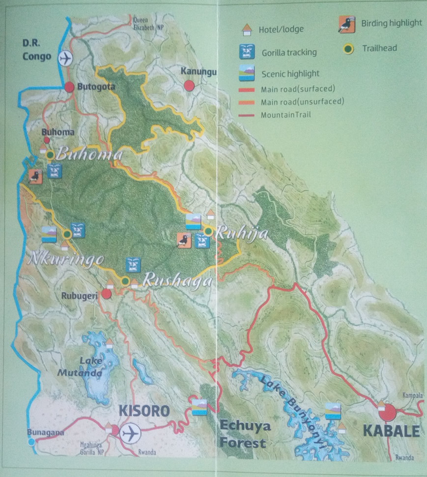
Map of Bwindi Impenetrable Forest National Park
What to see in Bwindi Forest
The biologically diverse nature of the forest provides a number of attractions to see from the rare afro montane vegetation, tropical trees, animals, and insects plus people as well. Bwindi has 11 species of primates, including Gorillas, chimpanzee, Hoest’s, red-tailed and blue monkey, black and white Columbus, olive baboon.
The park is also a home to 310 butterflies’ species, 88 moths, 200 trees, 357 bird species, 51 reptiles and 120 types of mammals.
Gorilla Trekking in Bwindi
Since the mountain Gorillas are the star attractions to the National Park, a number of visitors go to this forest specifically for Gorilla Tracking. The Park currently has four sectors/ trail heads for the activity namely Nkuringo, Buhoma, Rushaga and Ruhija. Each of these sectors has its own Gorilla groups/ families to track.
Each gorilla family is allowed to be tracked by only 8 people per day. The Mubare group in Buhoma was the first to be habituated for Tourism in the park back in 1993, and a total of 18 have now been habituated.
The mountain gorillas are not only rare but also endangered, with their total population estimated to be 1005 animals basing on the last census update made in June 2018.
Bwindi particularly is estimated to be with more than a half of this population and the rest shared by the other four parks that make the Virunga Massif shared by Uganda, Rwanda and Congo.
Other things to do in Bwindi
Birding
Besides Gorillas and other primates tracking, there is a lot else to do in this forest. Trails in Bwindi also provide remarkable opportunities to watch birds such as the Mubwindi Swamp trail that is renowned for Albertine Rift endemics including the localized green broadbill. Other trails include the River Ivi trail between Buhoma and Nkuringo, Buhoma Forest edge’s Munyaga River trail and the Ruhija’s bamboo trail that leads to the Rwamunyoni peak that is 2607m high.
Nature Walks
You can explore more of Uganda’s loveliest rainforest of Bwindi while on a nature walk. These can be arranged for you starting in the morning and ending in the afternoon. Nature walks provide a chance to view birds and primates along the forest edge, as well as expanse views of the Albertine Rift Valley to Lake Edward and Rwenzori Mountains, Virunga volcanoes among others on clear days.
Cultural Walks
Cultural/ community walks through forest edge villages at Buhoma and Nkuringo provide insights into the lives of the local Batwa (Pygmies) and Bakiga peoples. Also a walk to Buhoma village community will give you an opportunity to see the traditional homesteads, the local healer, the banana brewing, handicraft and cultural performances for Batwa.
How to get there
By Road
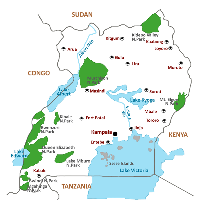
Bwindi can be reached from Queen Elizabeth National Park in the north (3-4 hours, 160Kms from Mweya in central QENP and only 62Km from Ishasha), from Kabale to the south (2-3 hours), or from Kampala via Mbarara (7-10 hours, about 460kms). The roads meet at Butogota, 17km from the Buhoma entrance gate. The Kabale – Ruhija- Buhoma segment on this route is 72 km on a murram road branching off at Harutenga junction on the Kabale-Kisoro road.
A 4×4 vehicle is however recommended during the rains.
By Air
Bwindi is well served by three air fields at Kayonza and Kihihi for the northern sector and Nyakabande in Kisoro for those going to track gorillas in the southern Sectors.
Travelers can fly from Entebbe (either from the Entebbe International Airport or the Kajjansi Airfield) to Kisoro for Nkuringo, Rushaga and Ruhija. Buhoma Visitors can fly to Savanna and Ishasha airstrips.
Where to sleep
There are several accommodation facilities at the four trail heads, catering for up-market, mid-range and budget visitors.
Accommodation facilities to be used include Gorilla forest camp, Mahogany springs, Engagi lodge, Buhoma lodge, Clouds gorilla lodge, Gorilla safari lodge, Ruhija lodge ( Luxury) Kitandara camp, Silver back lodge, Gorilla resort, Gorilla mist lodge (Mid-range) Buhoma camp, Bwindi view lodge, Nkuringo camp, Wagtail eco lodge, Marvel eco lodge (Budget) among others.
Ruhija sector can also be reached from hotels in Kabale and Lake Bunyonyi, while Rushaga and Nkuringo have the option of staying in Kisoro or Lake Mutanda.
Climate in the Park
Bwindi forest can be cold especially in the morning and at Night. The annual average temperature range is 7 to 20 degrees Celsius. The coldest period in between June and July. Bwindi receives upto 239 mm of rain per year.
However, the park can be visited any time of the year.